WAYPOINT
Făgăraș Ridge
Transfăgărășan · Făgăraș · Carpathians

Our Trails

We take you to where the trail begins. Fixed routes, clear drop-off points and GPS coordinates — from Sibiu and other Transylvanian cities into the Carpathians. Licensed, insured and professional.

Choose your range

We cover fixed routes across the Carpathians. Tap a marker — or a range below — to jump straight to its trailheads.
Făgăraș Mountains
Făgăraș Mountains
FĂGĂRAȘ
RIDGE

Făgăraș Mountains

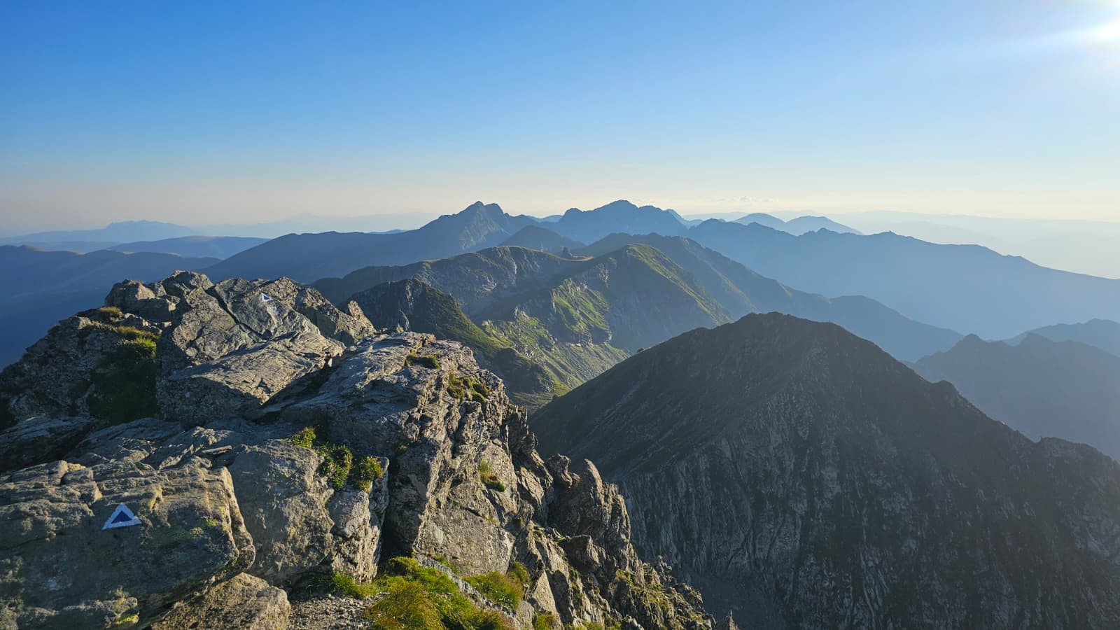
Făgăraș Ridge

Over 90km · Lotrioara → Plaiul Foii · 5–7 days

Multi-day
More details
Highlighted
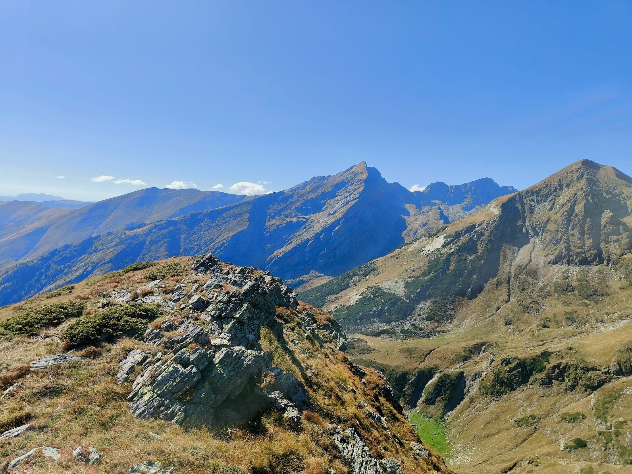
This is Romania's benchmark for long-distance hiking — a multi-day, exposed, demanding traverse of the Făgăraș Ridge, for hikers who've earned their legs on similar terrain. Runs either direction, Lotrioara ↔ Plaiul Foii — plan a custom start or finish point with the route builder below. You can always come down early, too — stop at Bâlea or another exit and we'll meet you there. For a single peak or a day hike, pick one of the trailhead sections below instead.
Făgăraș Ridge

Lotrioara

Start of the Făgăraș Ridge trail

Show waypointRidge startWestEast

Up to -30% on return · -10% if booked 14+ days ahead

Mănăstirea Turnu Roșu

Same drop-off, two trailheads — Făgăraș Ridge and Cabana Suru

Show waypointWestEast

Up to -30% on return · -10% if booked 14+ days ahead

Drop-off + Pick-up

Any two points, any dates — book both together and get 30% off the pick-up leg at the same point, or 15% off at a different finish point, within 30 days of the drop-off.

Plan your route
2283m

Făgăraș Mountains

Cabana Suru · Vf. Suru

1.450m cabin · three approaches to two summits

Asphalt + forest road
More details
Cabana Suru · Vf. Suru

Forest road parking

Closest to Cabana Suru — shortest walk in, via forest road

Show waypointRidge link

Up to -30% on return · -10% if booked 14+ days ahead

Avrig Valley Trail Start

End of asphalt on Avrig Valley — longer approach on foot

Show waypointRidge link

Up to -30% on return · -10% if booked 14+ days ahead

Sebeșu de Sus

Paved the whole way — longest walk, via a different line up the mountain

Show waypointRidge link

Up to -30% on return · -10% if booked 14+ days ahead

Mănăstirea Turnu Roșu

Same drop-off, two trailheads — Făgăraș Ridge and Cabana Suru

Show waypointRidge link

Up to -30% on return · -10% if booked 14+ days ahead

2034m

Bâlea

Transfăgărășan

Gateway to the Făgăraș Ridge

Asphaltyear-round / June–Oct
More details
Most popular
Transfăgărășan
2482m

Făgăraș Mountains

Șaua Podragu

Cabana Podragu · Lacul Podragu · Vf. Podragu 2.482m

Asphalt + forest road
More details

Muchia Tărâța — End of Asphalt

The panoramic ridge route to Cabana Podragu

Show waypointRidge link

Up to -30% on return · -10% if booked 14+ days ahead

Cabana Turnuri Trail — End of Asphalt

Through Valea Arpașului, to the saddle

Show waypoint

Up to -30% on return · -10% if booked 14+ days ahead

Făgăraș Mountains

Valea Sâmbetei

Former Cabana Valea Sâmbetei · Fereastra Mare a Sâmbetei 2.188m

Asphalt + forest road
More details
Valea Sâmbetei

Mănăstirea Brâncoveanu

End of asphalt at Sâmbăta de Sus, forest road continues

Show waypointRidge link

Up to -30% on return · -10% if booked 14+ days ahead

Barrier

Forest road barrier parking

Show waypoint

Up to -30% on return · -10% if booked 14+ days ahead

Retezat Mountains
Retezat Mountains

Retezat Mountains

Retezat Crossing

47,6 km · Cârnic → Cabana Pietrele → Lacul Bucura → Poiana Pelegii → Cabana Buta

Crosses the massif north to south — the most-used route into Retezat's core.

Multi-day
More details
Runs either direction, Cârnic ↔ Cheile Buții, ~18–19h of hiking — best split across multiple days.
Retezat Crossing

Up to -30% on return · -10% if booked 14+ days ahead

Up to -30% on return · -10% if booked 14+ days ahead

Retezat Mountains

Lacul Bucura

Căldarea Bucurei · Vf. Peleaga 2.509m · Papușa · Judele

The heart of Retezat National Park — Romania's largest glacial lake, ringed by peaks and smaller glacial lakes.

Asphalt + forest road
More details

Poiana Pelegii

Fastest way into the Bucura core — closest to Lacul Bucura, Vf. Peleaga, Papușa, Judele. Spectacular camping spot.

Show waypoint

Up to -30% on return · -10% if booked 14+ days ahead

Parâng · Bucegi

Coming soon

We're still mapping these ranges. Ask us for a quote and we'll share what we've got before it's public.

Ask for a quote

Custom route

Plan your route

Same point both ways? We'll come back for the pick-up.

Start — we drop you off

Finish — we pick you up

Passengers

Luggage

These are just a starting point — we'll try to make it work and confirm exact timing with you on WhatsApp.

Request this route
Mountain safety — Salvamont

Salvamont emergency number: 0725 826 668 ("0SALVAMONT") or 112

For wildlife, lightning, snake bites, calling for help and more — official Salvamont guidance, direct from the source.

Looking for a trailhead we haven't listed?

We operate across the Carpathians. Tell us where you want to go.

Send a request →